
For my birthday a couple months ago, this really great girl I'm dating gave me a set of maps of Canada that, based on the maps' provincial and territorial borders, date from somewhere around 1881 to 1889. She knows I'm a sucker for maps and old crap, and having served as a missionary in Quebec and Ontario, the great land of Canada is quite dear to my heart; so these maps were a perfect gift. (And she also got me a pizza peel and a pizza cutter, the kind that's a huge blade that rocks back and forth, which could also double as a weapon in the event of a home invasion.)
Here are the maps:
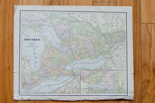
Ontario here was one of the first Canadian provinces when the Dominion of Canada was formed on July 1, 1867, although it was much smaller then than pictured on this map (it's even larger today).
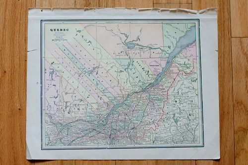
Quebec, which was incepted* the same time as Ontario, is my favorite province, if only out of pure bias: I spent the majority of my mission there. (Don't worry Ontario, you're a very close second.)
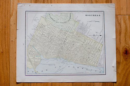
And finally we have Montreal. I've heard Montreal called the San Francisco of Canada but to compare it to that great city cheapens it a bit, as Montreal holds its own among the great cities of North America and the world.
Not pictured: A map of the entire Dominion of Canada circa 1881-1889. This one is hanging on the wall in my bedroom and I was too lazy to remove it from it's frame to photograph it.
*Not a real word.
== == == == ==
Like I mentioned earlier, I love maps. So it shouldn't come as a surprise that I spend an inordinate amount of time on Google Maps, on both the mobile app and full web versions. Anyway, these old Canadian maps got me thinking. How hard would it be to add a function to Google Maps that lets you take a map back in time to see the layout of a certain country or city, say, 100 years ago? Google Maps already has layers for traffic, weather, bicycling routes and more so adding another wouldn't be that hard. Time consuming? Sure, to pore over old maps and come to a consensus on where borders and roads actually were is no small task (I nominate myself for this job). But Google is known for taking on new projects a piece at a time, and this wouldn't be any different.
Am I the only one who'd be interested to see what my home town looked like 10 years ago? Fifty years ago? One hundred years ago? True, this function may not have an every day use like Google Maps' traffic or navigation features. But if you're like me and 75% of your Google Maps usage comes from perusing maps for the sheer joy of it, this function would be awesome. Or rather than adding a new function to Maps, maybe Google needs to create an entirely new product: Google History or Google Old World or whatever they feel like calling it.
Google, you already read my email so there's a good chance you're reading this too. Please make this happen.
== == == == ==
Can Apple Maps do this? Google Maps news: "Google's Street View Goes Into The Wild".
No comments:
Post a Comment